2014 Remote Automated Weather Station
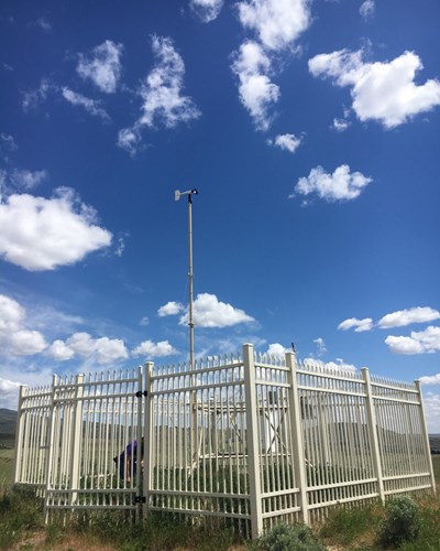
The Boise Front encompasses the Boise and Eagle foothills. This area has a longstanding history of severe wildfires, wind, and erosion. Wildfire’s strip the foothills of vegetative cover and exacerbate soil and wind erosion. Prior to 2014, no fire-specific weather stations were situated on the Boise Front, despite the fact that weather is one of the most significant factors in wildfire growth, direction, and severity. The combination of topography, fuel load, and severe weather in the Boise Front creates hazardous fire and erosion conditions for residents a the Boise Wildland Urban Interface. Firefighters and incident commanders require real-time localized weather information in order to better predict fire behavior. A Remote Automated Weather Station (RAWS) provides this information.
In 2014, a RAWS was placed above Claremont Dr - a location that has a historic fire regime. The RAWS will serve as a tactical resource for fire managers that respond to wildfires near the RAWS’ location. The RAWS includes a radio transmitter that an incident commander can tune into and receive real-time weather updates for that area. Additionally, the RAWS will provide long-term data for researchers at Boise State University and the University of Idaho-Boise. Information from the RAWS will also be available online to the public. You can view the Boise RAWS data live, here.
 The RAWS stands guard during wildfire season.